Map of Hamburg G20-Zones
City in Germany
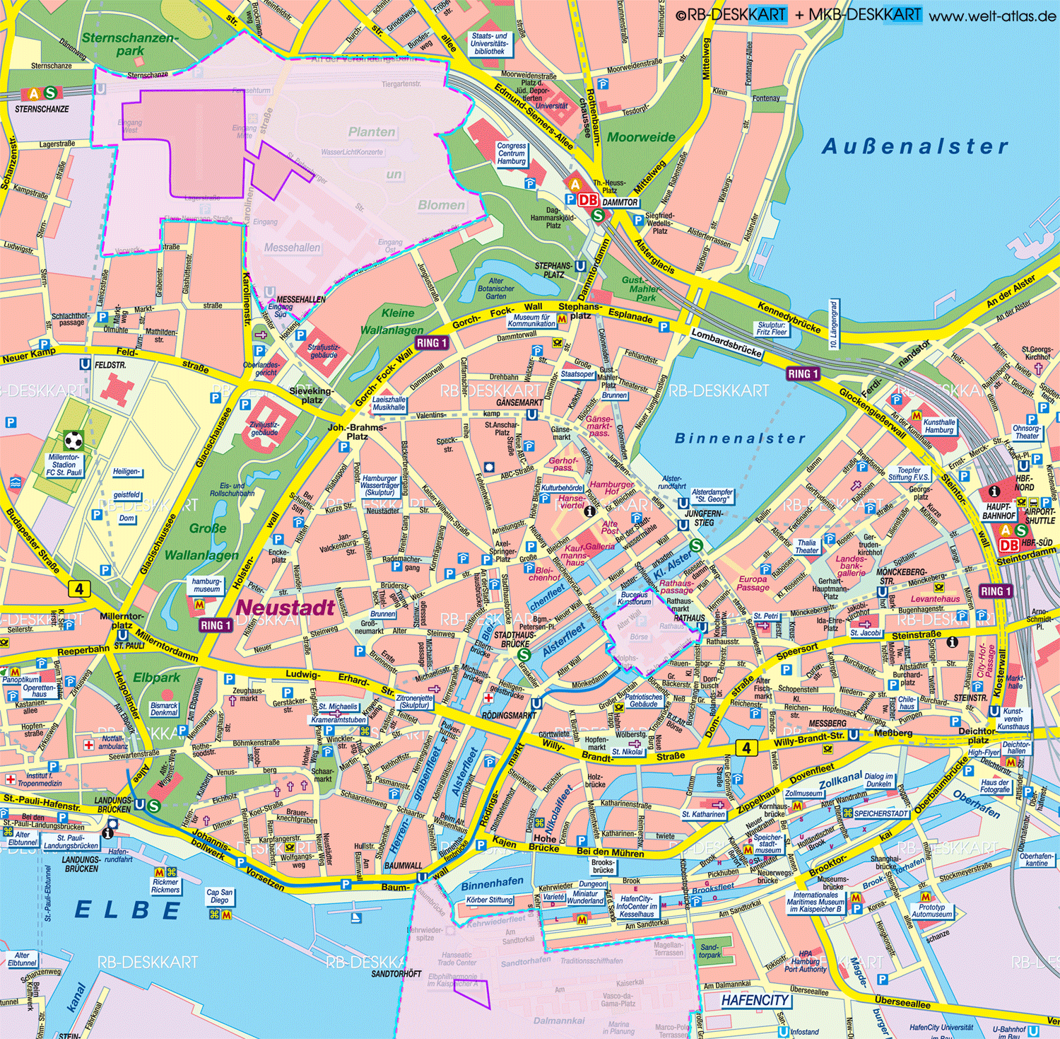
About this Map
Germany's second largest city and largest port on the Elbe. Area 755 km², 1.860.759 inhabitants (2.367 per km²). The city has 104 districts, divided into 7 districts. - Since July 2015 the Speicherstadt and Kontorhausviertel has been a UNESCO World Cultural Heritage site
- Anzeige -
Keywords of this Map
Stadthausbrücke Mönckebergstr. Jungfernstieg Landungsbrücken Baumwall Rödingsmarkt Rathaus Gänsemarkt Speicherstadt Hafencity Binnenalster Börse Kunsthalle Hamburg St. Nikolai St. Katharinen St. Michaelis Krameramtsstuben St. Petri St. Jacobi Millerntor-Stadion FC St. Pauli Rickmer Rickmers Alter Elbtunnel Überseebrücke Cap San Diego Speicherstadt Reeperbahn Planten un Blomen Elbphilharmonie Rathaus Aussenalster Messehallen Messegelände Hamburg Messe security zones
- Anzeige -